Map Reading Made Easy
Welcome to our ultimate guide on map reading made easy. Map reading is more than just a skill; it’s an adventure waiting to unfold. Whether you’re planning a hiking trip, exploring a new city, or embarking on a road trip, knowing how to read maps can enhance your experience and keep you oriented in unfamiliar territory.
With technology at our fingertips, the art of map reading may seem outdated. However, understanding this essential skill opens doors to exploration and self-reliance. Imagine standing atop a hill with an expansive view before you.
You pull out your map and pinpoint where you are while identifying landmarks around you—all without relying solely on your smartphone’s GPS. Map reading empowers you to connect with nature and navigate confidently through both urban jungles and natural landscapes.
Ready to dive into the world of map reading made easy? Let’s explore everything from basic skills to advanced techniques that will transform how you approach navigation!
The Importance of Map Reading
Map reading is a fundamental skill that fosters independence and confidence. In an age where GPS reigns supreme, the ability to interpret traditional maps remains invaluable. Understanding how to read a map allows you to navigate without relying on technology.
This can be particularly useful in remote areas with no cell service. It’s about connecting with your surroundings and gaining awareness of your environment. Moreover, map reading encourages critical thinking and spatial reasoning.
You learn to assess distances, elevations, and terrain types—all essential for outdoor adventures or urban exploration. Additionally, this skill enhances safety during travels. Knowing how to read emergency evacuation routes or locate landmarks can make all the difference in unfamiliar territory.
Mastering map reading enriches your experiences while traveling or hiking by deepening your appreciation of geography and nature’s layout around you.
Basic Map Reading Skills
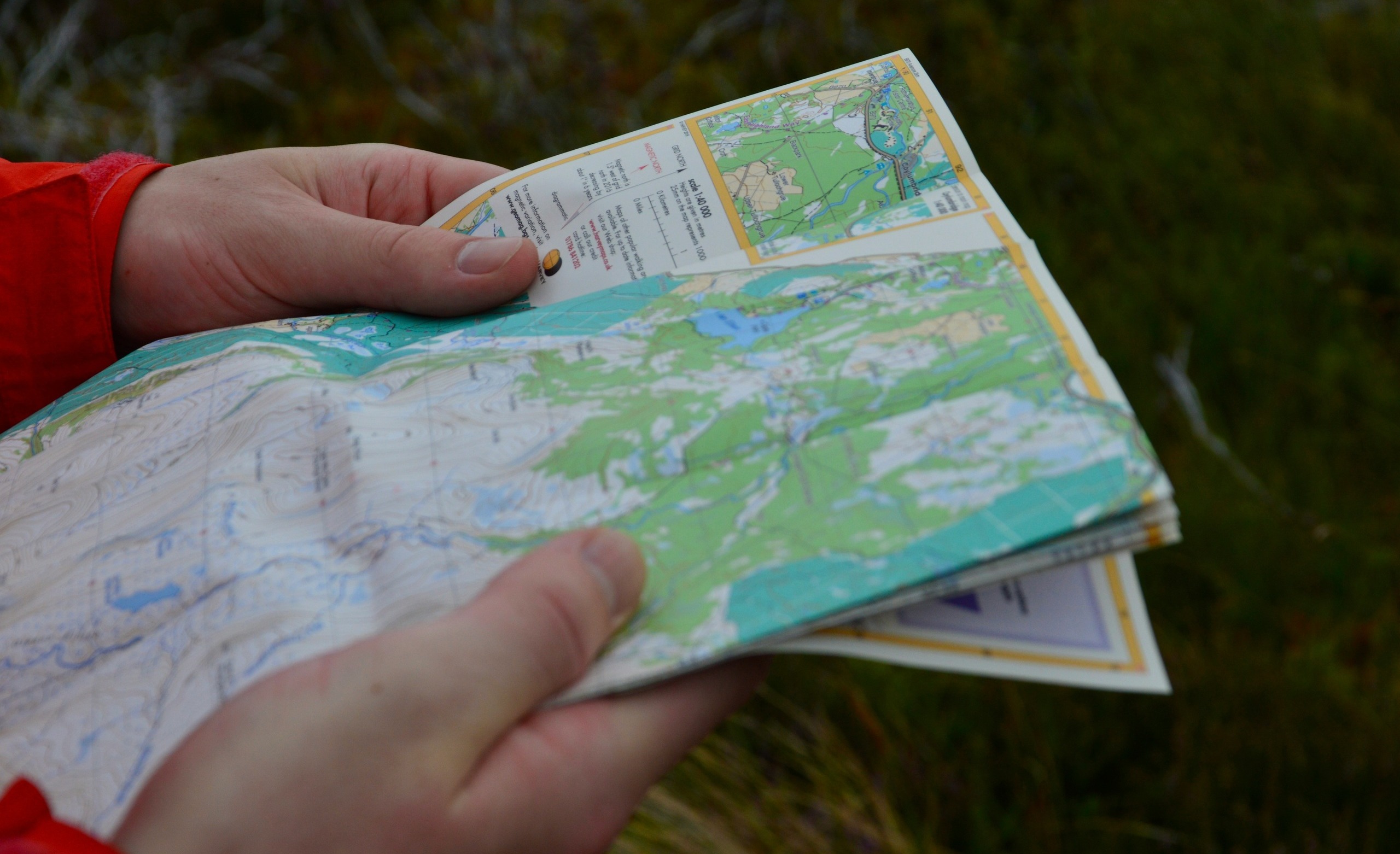
Developing basic map reading skills is essential for anyone looking to navigate the outdoors with confidence. Start by familiarizing yourself with a map’s orientation. Most maps are designed to be used with north at the top, but always check for any special notes.
Next, practice identifying key features like roads, rivers, and mountains. Understanding scale is crucial too; it helps you gauge distances accurately. Don’t forget about grid lines! They assist in pinpointing exact locations when combined with coordinates.
Another important skill is estimating travel time based on terrain types shown on the map. The more complex the landscape, the longer your journey may take. Regularly using maps in various environments will enhance your proficiency over time. Embrace each new experience as an opportunity to grow more adept at reading different kinds of maps.
Understanding Map Symbols and Legends
Map symbols and legends are the keys to unlocking a map’s secrets. They provide vital information about the terrain, landmarks, and routes you’ll encounter. Each symbol represents something specific—like a mountain or a river. Familiarizing yourself with these can transform how you read maps.
A small triangle might indicate a peak, while blue lines often depict water bodies. Legends serve as your guidebook. They explain what each symbol means in simple terms. Without this context, navigating would feel like deciphering an ancient language.
Take time to study the legend before setting out on your journey. It lays the groundwork for understanding distances and elevations too. As you learn more about these symbols, confidence grows. You’ll find that maps become less intimidating and more inviting tools for exploration.
Different Types of Maps and Their Uses
Maps come in various forms, each designed for specific purposes. A topographic map showcases terrain features like elevation and landforms, making it ideal for hikers and outdoor enthusiasts. Road maps are essential for drivers.
They highlight highways, major roads, and important landmarks to assist in navigation during road trips. Thematic maps focus on particular themes or subjects. These can represent anything from climate patterns to population density. They’re crucial for researchers and planners who need detailed data visualization.
For those interested in history, historical maps reveal how regions have changed over time. They offer a glimpse into the past that enriches our understanding of cultural landscapes. Digital maps have gained popularity with the rise of smartphones.
Apps provide real-time traffic updates and route suggestions, transforming how we navigate daily life. Each type serves its purpose effectively within diverse contexts.
Tips for Effective Map Reading
To master map reading, start by familiarizing yourself with the scale. This helps you understand distances and determine how far apart locations really are. Next, always orient your map. Align it with the physical landscape around you to gain a clearer sense of direction.
This simple step can drastically improve your navigation skills. Pay attention to contour lines if you’re dealing with topographic maps. These lines indicate elevation changes and can help predict terrain challenges. Practice mental mapping as well.
Visualize routes in your mind before setting off; this builds confidence and reduces reliance on printed materials. Keep a pen or pencil handy for notes or markings on the map. Jotting down points of interest or reminders will enhance your experience while keeping everything organized at a glance.
Navigating with a Compass
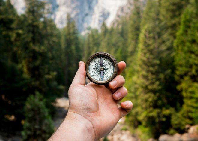
Navigating with a compass is an essential skill that complements map reading. A compass helps you determine direction, making it easier to follow your planned route. To start, hold the compass flat in your hand. Allow the needle to settle; it always points north.
By aligning the map’s north with your compass’s needle, you can accurately orient yourself. Next, identify your destination on the map and draw an imaginary line from your current location to that point. This will give you a bearing—a specific angle measured in degrees—that indicates where to head next.
As you walk, check back frequently to ensure you’re still heading in the right direction. Adjust as needed by rotating yourself until the needle aligns again. Using a compass effectively takes practice but becomes intuitive over time. It opens up new adventures while deepening your appreciation for navigation skills beyond modern technology.
Using GPS for Map Navigation
GPS technology has revolutionized how we navigate. With just a few taps on your smartphone, you can access real-time directions and traffic updates. Using GPS is simple. Enter your destination, and let the device guide you turn by turn.
It’s especially helpful in unfamiliar areas where traditional map reading might be challenging. One of the best features of GPS is its ability to reroute you when unexpected obstacles arise. Whether it’s construction or heavy traffic, your device adjusts routes to save time.
Moreover, many GPS applications allow users to explore points of interest along their route—restaurants, gas stations, or landmarks become easily accessible. However, reliance on GPS shouldn’t completely replace traditional map skills.
Knowing how to read maps can still come in handy during emergencies when devices fail or lose signal. Balancing both methods enhances navigation confidence and ensures you’re always prepared for any journey.
Common Mistakes in Map Reading and How to Avoid Them
Map reading can be tricky, and mistakes are more common than you might think. One frequent error is misjudging scale. Always check the map’s scale before estimating distances. A small oversight here can lead to significant detours. Another mistake is ignoring contour lines.
They provide crucial information about elevation changes. If you overlook these lines, expect unexpected climbs or descents on your journey. Relying solely on landmarks without confirming their position can also lead to confusion. Landmarks may change over time, so don’t assume they will always guide you accurately.
Many people skip the legend as well. The legend explains symbols used in the map, which helps unlock its full potential. Keep an eye out for orientation errors. Make sure your map aligns with the terrain around you before setting off; this small adjustment makes a world of difference in navigation success.
Fun Activities to Practice Map Reading
One of the best ways to sharpen your map reading skills is through scavenger hunts. Create a list of items or landmarks to find using a map. This not only makes it entertaining but also challenges you to navigate accurately.
Geocaching is another exciting option. It’s like a treasure hunt where you use GPS coordinates and maps to discover hidden caches. Each successful find boosts your confidence in reading maps. Joining hiking groups can also enhance your abilities.
Many trails have topographic maps, which help you understand elevation changes while enjoying nature. Alternatively, try mapping out local bike routes or walking paths. Documenting these journeys on paper helps reinforce spatial awareness and improves orientation skills.
Consider engaging with online games that focus on geography and navigation techniques. They provide interactive learning opportunities that make map reading enjoyable!
Conclusion
Mastering map reading is a valuable skill that opens up new adventures and opportunities. Understanding the basics, from symbols to compass navigation, empowers you to explore with confidence. With practice, you’ll become adept at using various maps and even GPS technology. Engaging in fun activities can solidify your skills further while providing enjoyment.
Remember, every journey begins with knowing how to read the map before you. Embrace these tips and techniques for an enriching experience as you navigate the world around you. Whether you’re charting a trail or finding your way through town, effective map reading transforms ordinary trips into extraordinary journeys!


Most people don’t know how to read maps anymore as they are too reliant on GPS, but you just never know when you won’t have a signal and the map will be the only thing that you have.
Learning how to use the scale on the map is also very important so that you can work out distance, as everything on a map looks really close until you measure it out.
I love your idea of using scavenger hunts to teach the art of map reading, and I am going to try this activity with my kids this weekend.
Hi Michel,
Thanks for stopping by and sharing your thoughts on our article map reading made easy. Back in the 80’s and 90’s, I owned a locksmith company in south Florida. I used to hire young guys that were mechanically inclined and willing to learn. As you could imagine, you have to know how to get around to service your customers.
Back in those days, there were no GPS devices not even cell phones. Even at that time, most people did not know how to read a map. That was the first skill I had to teach so I can only imagine how many people have map reading skills today. Please come back and let me know how your scavenger went.
Best wishes,